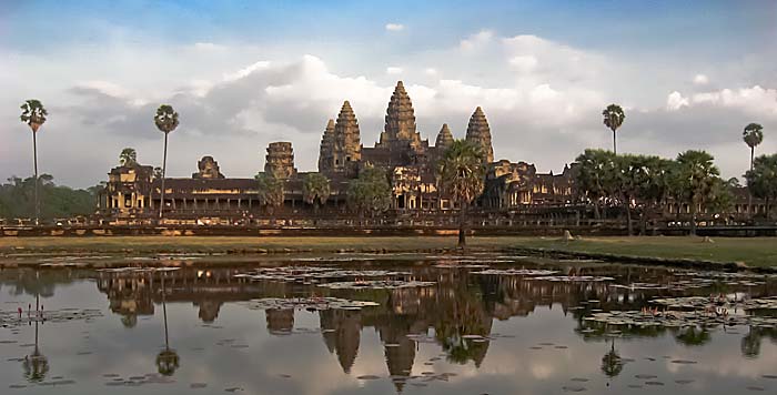
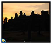
The monuments of Angkor are nowadays mostly UNESCO World Heritage. Most of them are concentrated in the former empire's center in Angkor Archaeological Park. More are scattered around in large parts of Indochina. Image by Asienreisender, 2015
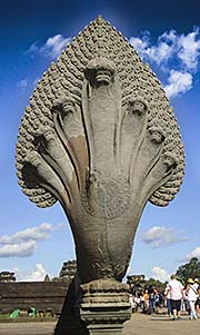
A seven-headed naga at the western gateway to Angkor Wat. Image by Asienreisender, 9/2015
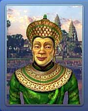
Suryavarman II, the so called 'builder' of Angkor Wat, as displayed in the legendary computer strategy game 'Civilization IV'.
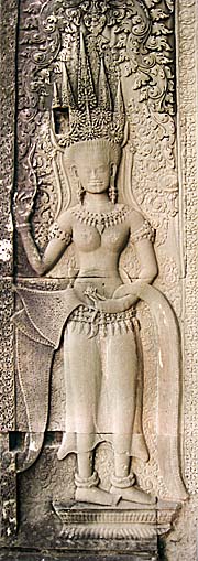
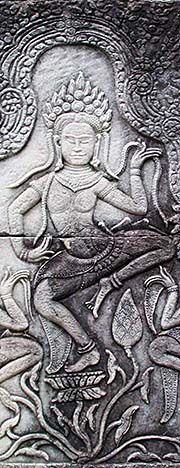
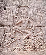
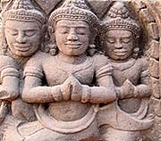
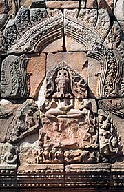
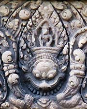
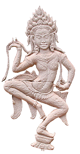
An apsara, carved in sandstone at one of the inner galleries of Angkor Wat. Apsaras are devine beings and appear in many variations in temple frescos and paintings until today. Image by Asienreisender, 2006
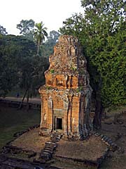
Phnom Bakheng, a mountain which was shaped into a pyramide with a temple set atop. The building project was ordered by king Yasovarman I in the early 10th century, who decided to move the empire's capital from the Roluos Group to here. It's therefore older than Angkor Wat and Angkor Thom. Image by Asienreisender, 2006
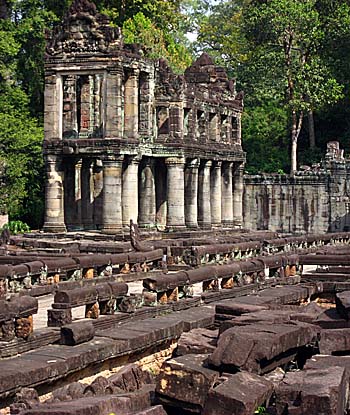
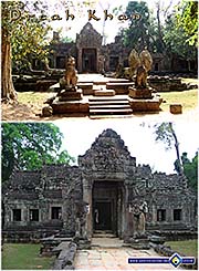
The large temple town of Preah Khan is supposed to have been a temporary capital of Angkor until it moved to Angkor Thom.
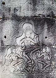
Dancing asparas in the pillars of the Bayon. Images by Asienreisender, 9/2015
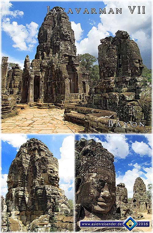
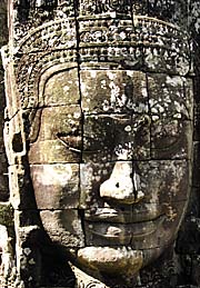
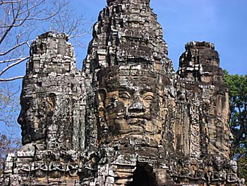
The 'Smile of Angkor', at the Bayon. Image by Asienreisender, 2006
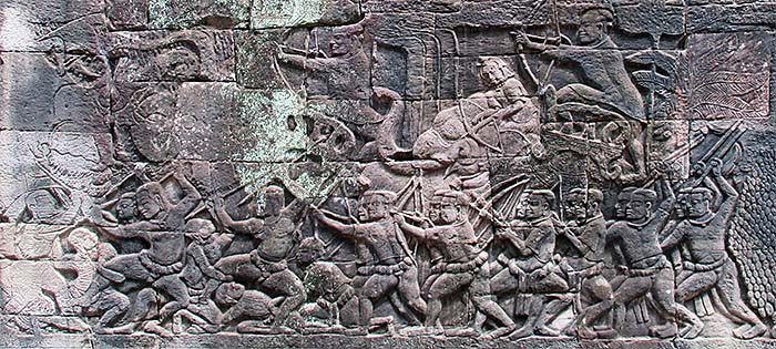
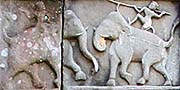
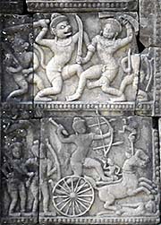
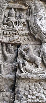
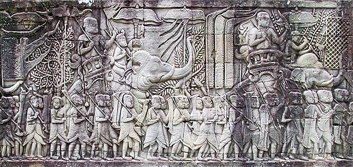
An elephant battle in Baphuon. Image byAsienreisender, 9/2015
Someone is shooting someone else in his back. Carving in Baphuon. Image by Asienreisender, 9/2015
Two bowmen. Carving in Baphuon. Image by Asienreisender, 9/2015
More carvings in Baphuon. Images by Asienreisender, 9/2015
Phimeanakas, a pyramid temple in the grand royal palace area of Angkor Thom. Image by Asienreisender, 12/2006
The east baray. Image by Asienreisender, 12/2006
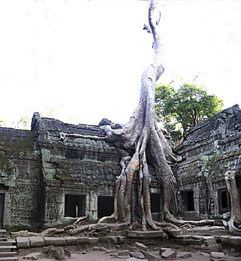
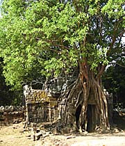
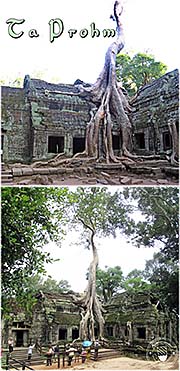
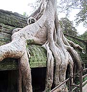
Ta Prohm is nowadays one of the major sights in Angkor Archaeological Park. Particularly the huge figtree which is overgrowing a centerpice of the old temple building is the background for countless tourist photos.
Carvings in Ta Prohm. Image by Asienreisender, 10/2015
The ruins of Ta Prohm gained some fame for having been left in a state of overgrown by the forest. Images by Asienreisender, 10/2015
Besides the very famous Ta Prohm in Angkor Archaeological Park there is another Ta Prohm at Tonle Bati, that is somewhat south of Phnom Penh. Very few visitors come to this Ta Prohm, although it is nicely restorated and very rich in carvings. Image by Asienreisender, 2/2015
Ta Prohm | Tonle Bati; the main prasat and one of the carvings. Images by Asienreisender, 2/2015
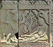
Carvings in Ta Prohm | Tonle Bati. Above: a temple guardian. Below: a woman get's trampled to death by a horse, while the king (above) is watching it. She was the king's wife and has betrayed him. Apparently, besides the king is sitting another woman. Images by Asienreisender, 2/2015
A shrine inside a prasat on Phnom Chisor. Hocuspocus and superstition coin all historical and present societies. Image by Asienreisender, 2/2015
Dancing deity with a cat at Phnom Chisor. Image by Asienreisender, 2/2015
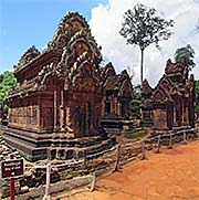
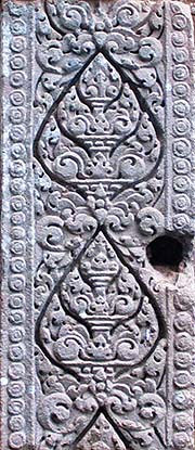
The temple compound of Banteay Srey is an outer site in Angkor Archaeological Park. It's built in red sandstone and particularly filigree. Image by Asienreisender, 10/2015
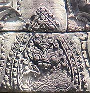
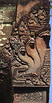
Cobra relief at Banteay Srey, outer Angkor. Image by Asienreisender, 2006
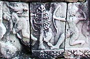
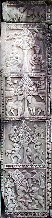
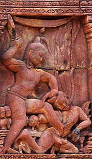
Carvings in Banteay Srey. Angkor's reliefs often display violence; partly it's scenes from the Ramayana epos, partly it's documenting happenings of the time. Images by Asienreisender, 10/2015
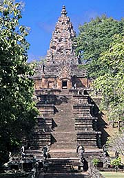
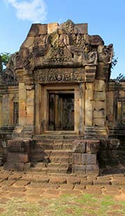
The temple of Phanom Rung in Isan is one of the pearls of Angkorean architecture. The state of the monuments in Thailand is much better than in Cambodia. Image by Asienreisender, 11/2015
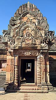
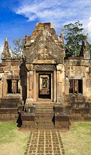
The entrance to the central shrine of Phanom Rung. Image by Asienreisender, 11/2015
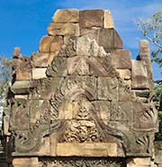
Carving in a lintel of Phanom Rung. Images by Asienreisender, 11/2015
Another carving in Phanom Rung. Image by Asienreisender, 11/2015
Kuti Rishi Kok Mueang, one of the supposed 102 arogyasalas (hospitals or nursing homes) according to an inscription in Ta Prohm. It's placed between Phanom Rung and Muang Tam in the countryside of Buriram Province. Image by Asienreisender, 11/2015
Prasat Muang Tam, an Angkorean sanctuary in Nang Rong district, Buriram Province, Isan. It's a pearl of Angkorean architecture. Despite the attraction of the sight, very few visitors come here. The Thai Fine Arts Department did, as they do everywhere in Thailand with their cultural heritage, a great job in restorating and maintaining the site. All the historical sites in Thailand are in a much, much better shape than those in Cambodia; while the entrance fees are moderate or one comes sometimes in for free. The Cambodians do it the other way: they do nothing for preservation, but cadge a maximum of profit out of the sights of Cambodia. Images by Asienreisender, 11/2015
One of the four remaining prasats in Muang Tam. The fifths, central shrine does no more exist. Image by Asienreisender, 11/2015
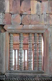
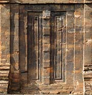
A false window and a false door. Typical for Angkorean monuments. Images by Asienreisender, Muang Tam, 11/2015
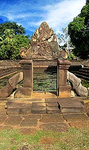
An entrance gate to one of the pools who surround the central shrines of Muang Tam. There were ritual bathings hold in the old times. Image by Asienreisender, 11/2015
Demons, carved into two of the lintels of Muang Tam. They guard the place... Images by Asienreisender, 11/2015
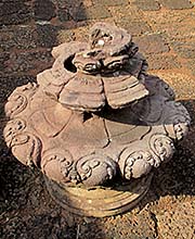
A lotus bud; they are often put on top of the prasats. Image by Asienreisender, Muang Tam, 11/2015
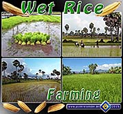
Rice farming was a basic innovation by people who started to live sedentary. The fertile plains north of Tonle Sap Lake allowed the medieval Khmer to harvest up to four times a year, due to their highly sophisticated irrigation system. Wet-rice cultivation allowed them to develop the largest preindustrial city in world's history.
The ruins of Angkor as the background of fashion display for the dull marriage industries. Image over substance is not only an Oriental phenomenon, but one of modern man in general. Image by Asienreisender, Battambang, 9/2015
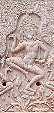
The image top right shows an apsara carving in one of the pillars of Bayon.
Images by Asienreisender, 2006, 2015
Angkor - The Empire of Angkor
1.
The Empire of Angkor
The medieval empire of Angkor was the most significant state and civilization in Southeast Asia for about 600 years. It was remarkable above all for it's hydraulic architecture, represented in a vast irrigation and canal system, topped by numerous monuments. It preserved a cultural long-term influence on Indochina until today.
Angkorean Gopura
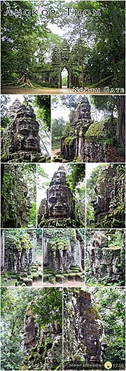
The top of the south gate of Angkor Thom. The four heads of a Boddhisattva show in all directions and see anything. It's the godking Jayavarman VII, who smiles the 'Smile of Angkor'. Image by Asienreisender, 2006
But it was not only extraordinary for Southeast Asia. Angkor stands the comparison with the other great empires of world's history. Angkor city was a huge, sophisticated urban center and, at it's height, the greatest preindustrial city in history. It was home for up to a million people in it's best times. A huge transport and irrigation infrastructure was part of it. The construction of Angkor Wat alone, what was the empire's state temple in the 12th century, was a gigantic performance. The whole organization of the building site was a major challenge. It included the gain of a huge amount of stone material from the Kulen quarries, the transport of all the many tons of stone over a distance of 40km to the building site, the workmanship into all the absolute precisely fitting single pieces, the procession of the material's surface into all the brilliant carvings.
The building time of gigantic Angkor Wat lasted below 40 years. It is the largest religious building in the world. Compared with the European cathedrals it was built in a fraction of the time. Only the cathedral in Salisbury in England had such a short building time, but is a much smaller building. The construction of other cathedrals took normally between 200 and 300 years. The grand dome in Cologne in Germany was built in a timespan exceeding 650 years. In fact it's still not completed. Well, in fact Angkor Wat isn't fully completed either. And, beside Angkor Wat were many more monuments built by this remarkable hydraulic civilization. In what is nowadays Angkor Archaeologcial Park were more than a thousand monuments erected in total, among them hundred big ones. Many more are scattered over the Map of Indochina, namely in nowadays Thailand, Laos and Vietnam.
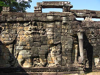
Terrace of the Elephants
Fresquos at the Terrace of the Elephants show us scenes from the 13th century, as they might have happened on Victory Square in Angkor Thom. Image by Asienreisender, 2006
However, the famous monuments were so to say only the cream on top of the cake. The hydraulic civilization of Angkor was based on it's huge irrigation system.
Angkor was a historic late-comer. It represents historically a first-generation civilization, on the level with those of ancient Egypt, Mesopotamia, the early civilizations at the Ganges and Yangze Rivers. It's origins are clearly Indian, as it's predecessors Funan and Chenla were. All these have in common that they based on a hydraulic 'backbone'. The beginning of all the grand Oriental civilizations was the massive extension of an irrigation system to cultivate grain, in our case rice. Those ancient people who learned to built irrigation canals learnt also to built dikes. Those who built dikes learned to built walls. Those who built walls learned to built towers. Those who built towers learned to built buildings such as monuments, and this technique was developed higher and sophisticated until the construction of the famous historical buildings like Angkor Wat, the Bayon, Ta Prohm, Preah Khan and many more.
The requirements for such monumental architectures lay in the central organization of a huge working force. The irrigation system allowed a large surplus of food, feeding hundreds of thousands, later millions, who were under the central command of a despot in total power. Apart from a ruling cast of priests, the whole population was in different degrees enslaved. The large population allowed, beside the workforce, also a big army which was sent into the neighbouring countries to conquer the riches of their people and to enslave them to furtherly support the empire's workforce.
The Army of Angkor
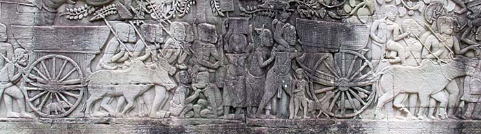
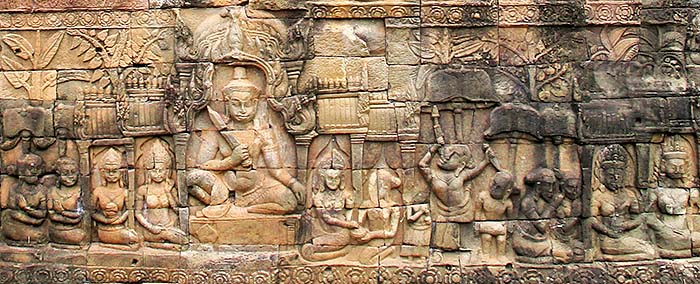
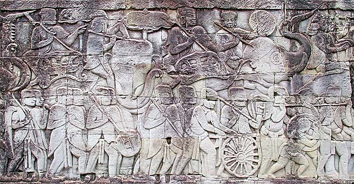
In medieval Europe eight or nine farmers fed ten people, means only ten to twenty percent of the population was able to do anything else but farming. The relation in Angkor is not clear, but the fertile rice paddies with the excellent irrigation system, together with the riches of fish in Tonle Sap Lake allowed certainly a much larger proportion of the population to follow other purposes. Apart from the ruling priest cast and the artisans, it was particularly the army which allowed the empire to expand militarily. Angkor was a highly militarized society. That is reflected in the large proportion of military depictions of the Angkorean war machine in the bas reliefs of Angkor Wat and, like here, the Bayon. Image by Asienreisender, 9/2015
The Military in Hydraulic Civilizations
The hydraulic civilizations that maintained large armies generally also had large populations. (...) The masters of the hydraulic state, who monopolized coordinated military action, could - if they so wished - raise large armies. Their mobilization potential was entirely different from, and greatly superior to, that of feudal Europe.
(...)
Organized control over the bulk of the population in times of peace gives the government extraordinary opportunities for coordinated mass action also in times of war. This becomes manifest as soon as we contemplate such crucial aspects of defense as the monopolization and coordination of military operations, organization of supplies, military theory, and potential size of the armed forces.
The sovereign of a feudal country [medieval Europe] did not possess a monopoly of military action. As a rule, he could mobilize his vassals for a limited period only, at first perhaps for three months and later for forty days, the holders of small fiefs often serving only for twenty or ten days, or even less. (...) The national sovereign had full control only over his own troops, which (...) constituted only a part - and often a not very large part - of the temporarily assembled national armies.
(...)
In all these respects the armies of the hydraulic state proceeded on an entirely different level. The soldiers were not protected by democratic checks or feudal contracts. No matter whether they held office land or not, they came when they were summoned; they marched where they were told; they fought as long as their ruler wanted them to fight; and there was no question as to who gave the orders or who obeyed.
(...)
The army of a hydraulic state might include among those it drafted many persons of poor training and little fighting spirit. With regard to skill these men might compare unfavourably with a feudal host, whose members were carefully trained, and with regard to morale they might be inferior to the warriors of both ancient Greece and feudal Europe. But in planned coordination they approached the ancient Greeks; and they far surpassed the European chevaliers.
(...)
The masters of hydraulic society applied the same organizational devices in the military sphere that they employed with such success in construction and communication. In many cases, the recruits for war could be as comprehensively mobilized as the recruits for toil. The assembled armies moved in orderly fashion, and camping and scouting were often highly developed. Whenever feasible, the armies lived off the land; but numerous means were invoked to cope with possible shortages.
(...)
In the hydraulic world the organization of warfare was elaborately discussed. Military experts liked to evaluate their experiences in treatises on tactics and strategy.
Karl A. Wittfogel: "Oriental Despotism - A Comparative Study of Total Power"
Image by Asienreisender, bas relief of the Bayon, 10/2015
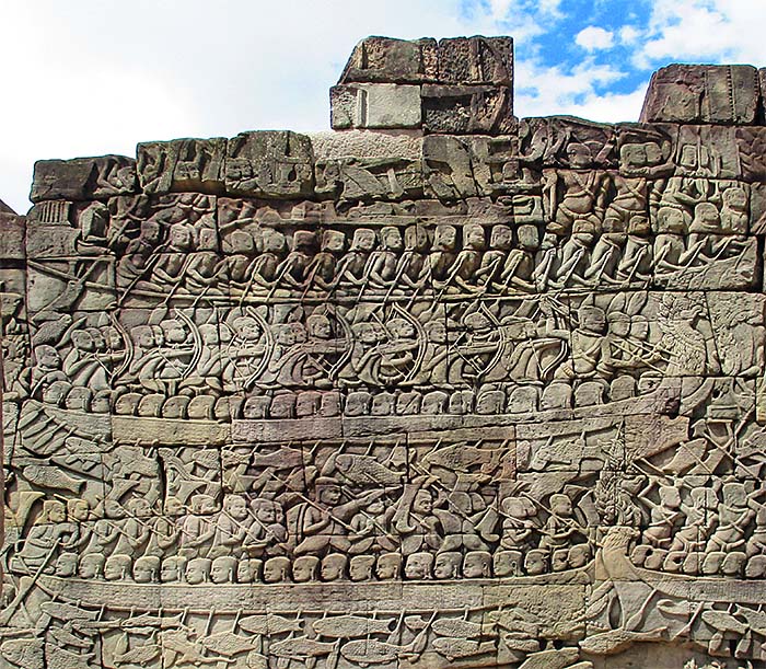
The Angkorean Navy
The whole southeastern bas reliefs of the Bayon are depicting the navy of Angkor; that's just a cut-out. I never found a hint that Angkor had a larger sea navy; seems, they were mostly ruling the rivers and, above all, Tonle Sap Lake with their rowboats. Image by Asienreisender, 9/2015
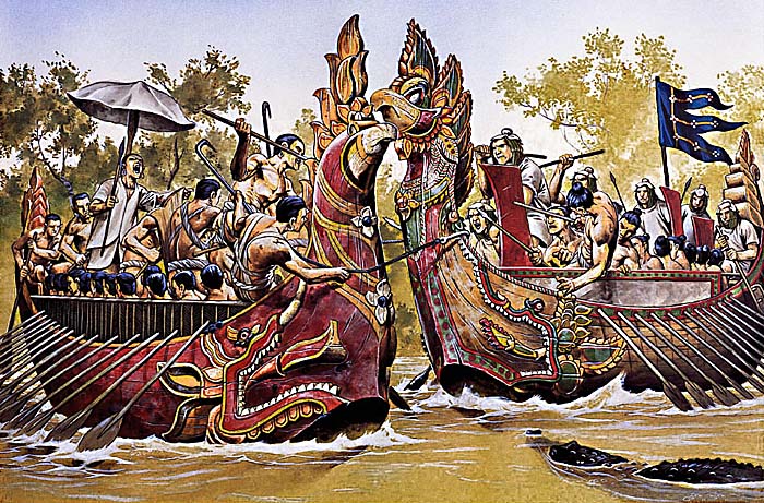
Naval Battle
The illustration shows two war canoes, fighting in the uprise against the Cham occupation, which was led by Jayavarman VII in 1177 CE. The left canoe is Khmer, the right one is Cham. In the foreground is one of the crocodiles to see, who appear on Khmer depictions of the time in Angkor Thom. They were keen to attack anybody who was thrown out of one of the vessels.
2.
The Foundation of Angkor
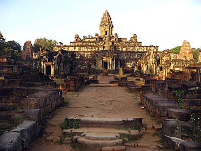
Bakong Temple
Bakong, the main temple of the Roluos Group. Roluos, respectively Hariharalaya, was one of the very first capitals of Angkor, an already existing town adapted by Jayavarman II at the founding time of the empire in the early 9th century. Image by Asienreisender, 2006
In the late 8th century, a local king with a close connection to the Sailendra dynasty in Java, leader of one of the petty Khmer states in the Mekong Delta, decided to move it's capital riverupwards into the region of the great lake of Southeast Asia, the Tonle Sap. Jayavarman II, who was supposedly reigning for 48 years (802 to 850 CE, however, the exact timespan of his reign is controversial), overcame the Javanese mastery and founded a state which would last over 600 years as Southeast Asia's dominating empire.
However, we don't know much about Jayavarman II. There is nothing about him to find in Chinese chronicles, and the Khmer traces, consisting only of the rare stone inscriptions they left in the monuments of the Roluos Group, give little information. According to temple inscriptions, the foundation of Angkor can be dated for the year 802 CE. In the time before the king managed anyhow to unify all the Khmer petty states to a single unit, ruled by himself.
In Jayavarman IIth reign the new empire's capital was moved three times to three different sites near the great lake. The first and last one was Roluos, where the king eventually died. The reason for shifting the capital was probably due to pressure coming from the Champa empire. The Champa were the arch rivals of the old Khmer. Another reason for the shift was the fact that the great lake region was far away from the seaside and therefore out of the direct access of the powerful fleet of the Javanese empire.
3.
The Grand Monuments, or:
The Monument Building Obsession
Jayavarman II and his son and successor Jayavarman III let built some smaller monuments and shrines. The obsession to build big and ever bigger monuments began in the years before 900 CE. King Indravarman I let a first large baray (an artificial lake) built, together with Preah Ko and Bakong. His successor, Yasovarman I ordered another baray and the construction of Phnom Bakheng, where a whole mountain was shaped as a pyramid and topped with a great temple. It's situated between Angkor Wat and Angkor Thom and famous for tourists watching the sunsets at Angkor. In Yasovarman Ith reign falls also the construction of the large easter baray, for which the Siem Reap River was split.
Now every succeeding Khmer king ordered more and bigger monuments, topping the predecessors. Takeo temple was built in the reign of Jayavarman V, and Suryavarman I (reign: 1002 - 1049) ordered the construction of the huge west baray, famous Preah Vihar in the Dangrek Mountains and a number of other temples. Suryavarman II then ordered famous Angkor Wat as a personal mausoleum. His successor let Bakong temple expand and Jayavarman VII, who fought the Champas out of of Angkor, ordered Angkor Thom's construction with the Bayon, Ta Prohm, Preah Khan, Banteay Chhmar, 102 hospitals and large waterworks, and additionally a number of smaller and medium-sized temples, some of them further away from the capital Angkor itself.
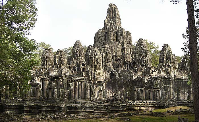
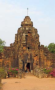
The Bayon
The ruins of the Bayon, the central piece and state temple in Angkor Thom. Angkor Thom was a whole new capital what was ordered by Jayavarman VII in the late 12th century. The name of this king is connected to a great deal of buildings in the whole empire who were built in his reign, which not exceeded 40 years. The construction speed was breathtaking. For many of the construction workers it must have been neckbreaking as well. Image by Asienreisender, 2006
Jayavarman VIIIth reign marks the climax of Angkor's building activities. In a fast speed monument after monument was built.
All these big constructions were accompanied by an infrastructure of streets, canals, bridges, hospitals and rest houses. In the Angkorean empire a wide network of roads was built and maintained. They were well done as highways who led through the swampy marshlands of Indochina, while the bridges were of remarkable quality and artfully made.
The rich travelled carried on biers or on the back of elephants or horses, while the poor either rode on water buffaloes or walked. Waterways were very much in use. Particularly in the rainy season many travellers went by boat over large distances to their destinations.
4.
Angkor as a Hydraulic City
The main reason why the Angkorean empire could employ so many people in construction work lies in the fertility of the plains around Tonle Sap Lake and the abundance of fish in the lake and surrounding rivers. According to Zhou Daguan, the ancient Khmer could harvest four rice crops a year. That would have made an enormous difference to the usual once-a-year harvest. Maybe it's exaggerated or it was exceptional, and there were three or two harvests 'only', varying according to weather conditions and crop pests, but anyway, it still enabled the Khmer elites to spare a great number of farmers and deploy them into other tasks. Particularly recruiting them into the army.
The huge west baray, west of Angkor Thom, was/is the largest artificial water reservoir in Angkor. It's rectangular shaped and measures roughly eight to two kilometers. It was part of a gigantic hydraulic system which allowed the empire growing big. Image by Asienreisender, 9/2015
The French archeologist Bernard-Philippe Groslier published two articles in 1974 and 1979, in which he introduced the 'hydraulic city' hypothesis. According to Groslier the four great barays (three are known today, another one was recently discovered on satellite images) and the sophisticated canal system of Angkor served, beside other purposes, as an irrigation system.
Angkorean Canal
The remaining canal between west baray and Angkor Thom's outer moat. Image by Asienreisender, 9/2015
This idea sounds very plausible, but came under dispute. Other experts pointed out that there are no hints for an irrigation system, and the barays do not have a connection to the canal system. The rice paddies were encircled with small dikes, catching and keeping rain water, as as it is in practice still today.
Above all the Mekong and Tonle Sap river system show a peculiar behaviour every year. In the annual rainy season, when the water level of the Mekong River is rising considerably, the water at the lower Mekong can not drain quick enough into the South China Sea. The water is therefore partially flowing riverupwards into the Tonle Sap River, filling up the great Tonle Sap Lake and flooding the flat plains around. It comes with a considerable amount of silt which enriches the fertility of the whole region. This natural irrigation system is seen as causal for the fertility of the region around Angkor. The barays therefore served, in the view of some scholars, merely religious purposes.
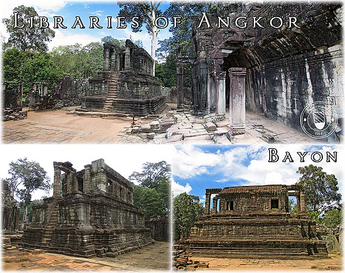
The Libraries of Angkor
Although the afterworld never found a single piece of the writings of the Angkorean libraries, it's pretty sure that they contained much more than merely made-up religious belief systems.
In a hydraulic setting the need for comprehensive organization is inherent in the comprehensive constructions necessitated or suggested by the peculiarities of the agrarian order.
These constructions pose numerous technical problems and they always require large-scale organization. To say that the masters of hydraulic society are great builders is only another way of saying they are great organizers.
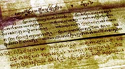
Khmer script on a traditional scroll in the Royal Palace of Phnom Penh. Palm-leaf paper doesn't stand the humid tropical climate for long; it has to be kept dry. Image by Asienreisender, 12/2014
An organizer combines disparate elements into an integrated whole. (...) He must make more elaborate preparations if he is confronted with a permanent and difficult task. Dealing with human beings - their labor power, their military potential, and their capacity to pay taxes - he must know their number and condition. To this end he must count the people. And whenever he expects to draw from them frequently and regularly, he must preserve the results of his count either by memorizing them or, above the most primitive level, by utilizing preliterary or literary symbols.
It is no accident that among all sedentary peoples the pioneers of hydraulic agriculture and statecraft were the first to develop rational systems of counting and writing. It is no accident either that the records of hydraulic society covered not only the limited areas of single cities or city states, of royal domains or feudal manors, but the towns and villages of entire nations and empires. The masters of hydraulic society were great builders because they were great organizers; and they were great organizers because they were great record keepers.
(...)
Herodotus, in a frequently quoted passage, tells how in Achaemenian Persia the sovereign himself supervised the major hydraulic operations: "The king orders the floodgates to be opened toward the country whose need is greatest, and lets the soil drink until it has had enough; after which the gates on this side are shut, and others are unclosed for the nation which, of the remainder, needs it most."
Karl A. Wittfogel: "Oriental Despotism - A Comparative Study of Total Power"
Images and photocompositon by Asienreisender, 9/2015, 2016
According to some of the inscriptions of the Angkorean buildings the water infrastructure had multiple purposes, religious as well as that of a transport and an irrigation system. It would be very weired to build such an enormous canal net with huge, several square kilometers large artificial lakes and then not to use it for all possible purposes, particularly rice field irrigation. First comes food, and all culture is built then on top of a filled stomach. Also the last revelations of the LIDAR research, which shows a greater extend of the canal and water system as previously known, support the idea that the system was used for multiple purposes, including irrigation.
Probably the barays served additionally also as fish ponds, as swimming pools, for ritual bathings and as tools of flood control.
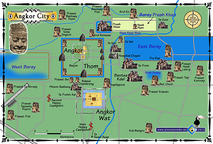
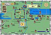
Map of Angkor City | Angkor Archaeological Park
The map shows the ancient Angkor City site as it looks now as Angkor Archaeological Park. What we see being left from the water and irrigation system is just a fraction of what there was in the past. The LIDAR satellite images show a fine net of small canals penetrating the whole landscape, particularly Angkor Thom. Angkor Thom was a 'city in the city'. It was home for the huge royal family in the royal palace, the high nobility and an elitarian circle with a large staff of functionaries, who were also residents or at least worked there.
The map still only shows a part of the whole extension of the ancient city of Angkor. It stretched widely out in all the four directions of the compass. In the southeast there is the Roluos Group (now more on the map), one of the very first capitals of Angkor. Some kilometers northeast lies Banteay Srey (not on the map), a very particular site with a very distinctive architectonical and ornamental style. Alltogether there are some hundred major temple sites in Angkor, and additionally some nine hundred middle-sized and smaller monuments.
What we see nowadays, when visiting the ancient Khmer sites, is merely a skeleton of the former state of the infrastructure. Verymost of the material is long since rotten away. Only the most solid stone parts of the constructions are left.
Being impressed by the grandeur of the grand monuments and the seemingly magnificient past of the Angkorean civlization, most visitors to Angkor don't pay much attention to what kind of civilization it was.
Ancient Angkor's society was highly stratified and there was little social mobility. It was, as all the ancient empires, and particularly all the Oriental despotisms, based on slavery.
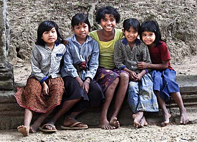
Cambodian kids inside Angkor Archaeological Park. The ancient Khmer kids have probably looked quite similar, apart from the clothing. The Khmer are of Indian origin. Supposedly, these Indian settlers came from south India via Indonesia as seafarers into the Mekong Delta, around 2,000 years ago. Additionally, there is a permanent stream of migration in almost any society of the past and the present, what means a slight, but permanent change. Image by Asienreisender, 12/2006
The social order was accepted, as in most if not all societies in the past and the present, as a 'natural' order. Privileged deserved their position due to birthright. It was explained with the 'kharma' one gained in earlier lives. The promised reward for honesty, modesty and obedience was a higher status in a coming live. Legends like the 'churning of the sea of milk', as depicted in Angkor Wat, fed the hopes of the underprivileged. And these promises were necessary, because the life for the slaves and the common people wasn't easy. They had to pay the price for the ridiculous pomp of the upper classes.
The idea of 'freedom' seemed to have been completely unknown, and there were not even terms in the ancient Khmer language for it. Nevertheless it seems that there have been some 'plebejan' revolts, who, however, were brutally beaten down.
There must have been many slaves, hundreds of thousands, in Angkor. Zhou Daguan wrote that only the poorest peasants didn't own at least a single slave. Among the slaves were debtors, former members of hill tribes and prisoners of war. Of course, slavery was hereditary. While the slaves where at the bottom of the social hierarchy, it leveled upwards to the peasants (also deployed as common soldiers or builders), the priests, the noblemen, the royal family and up to the king, who himself represented by distance the highest member of Angkor's society. The contemporaries had to accept the king as a 'devaraja', a godking.
The Concept of the Devaraja (Godking)
The godking's power overcame even the power of the European kings in feudalist and absolutist times (based on the idea of 'divine right'). The European kings were set in power by god, claimed the legitimation pattern in the west. Here, in Angkor, there was no higher authority in the universe than the king - he represented a godlike being himself. Angkor's kings were believed in being incapable to break any religious law. They were the central source of all the laws in the whole empire.
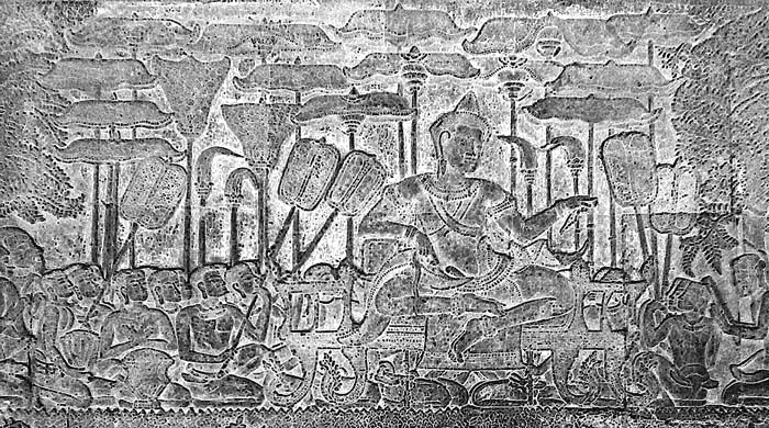
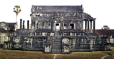
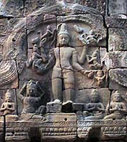
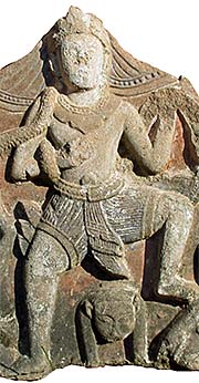
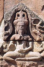
Suryavarman II
Suryavarman II on a fresco in Angkor Wat. The king is already physically much bigger than his subjects. Besides he is placed in a higher position, his head towering over those of the subjects. Above the congregation are parasols and right and left five fans.
As Zhou Daguan observed in 1296/97, Angkor's king Srindravarman was clothed with precious garments and
bedecked with the most exclusive jewelry. Additionally to his five official wifes the king had another three to five thousand concubines and palace girls around him in the palace.
Clothes represented the social status of an individual. While the peasants, men and women, weared a kind of loincloth only, representants of higher classes were dressed more sophisticated, but only the king was allowed to be fully clothed over the whole body. Silk for the rich was probably imported from China. It was forbidden for the members of a certain class to dress as the members of other (higher) classes, even if they could afford it. A dark suntan was an attribute for the lower classes, who worked outdoors and were exposed to the sun; a fair complexion, as still nowadays, was appreciated for the higher classes.
Jayavarman VII
As it is typical for hydraulic civilizations, Angkor's monumental architecture is built large and pompous. It comes with a typical aesthaetical style. The 64 heads of the godking are an expression of that. Images and photocomposition by Asienreisender, 9/2015
The king or his concubines rarely left the palace, with the only exception of the celebration of grand parades and presentations on Victory Square in Angkor Thom. Then the king was accompanied by princes, ministers, masses of palace girls and, of course, his bodygards. They were appearing on elephants and in chariots with flags, banners and music. The elephants and the royal vehicles and every detail of the procession was bedecked then with all kind of decoration. A great ancient circus. When the king travelled over land, anybody who saw the royal caravan from close or from far had to prostrate immediately and to touch the ground with his or her forehead. Someone who failed to do that had to expect severe punishment. The royal henchmen were known for opening their bodies and taking the gall bladder out, for later ritual purposes.
In the more than 600 years between 802 CE and 1431 CE, Angkor had 28 kings in total. To be a king required basically a proofed bloodline back to the founder of Angkor, Jayavarman II. Since there were many who could 'proof' or claim that, there were always several aspirators for the throne. And some wouldn't necessarily accept the ruling king, but challenging his rule. The close family members of the king, who were grown up with him for example, knew of course that the claim of being a devine being was mere invention and supported by a lot of hocus-pocus. Everybody around the king had to swear an oath of loyalty. Breaking the oath was to be punished with eternal damnation. Nevertheless, there were always members of the royal court who tried to oust the king and replace his position. A prominent example of a coup d'etat in Angkor is the case of Suryavarman II, who killed his predecessor and took the thron over. He ordered later the construction of Angkor Wat.
The kings of Angkor were very well aware of such threats from potential usurpators. Zhou Daguan reported on extensive security measurements for the king.
The Jurisdiction
The methods to find out guilt were as weired as the punishments were draconian. Zhou Daguan for example wrote that both the plaintiff and the accused were locked into stone towers for several days. The one who first would fell sick or couldn't stand the captivity anymore was 'proofed' to be guilty. Daguan wrote that that happened in the brick buildings of Suor Prat. Another example is that accused have sometimes been thrown into waters inhabited with crocodiles. When they survived that, they were 'prooved' innocent. Being killed by the beasts meaned they were guilty anyway and deserved the punishment.
Trial by Ordeal
Crocodiles played a decisive role at the Angkorean court. The ancient Khmer applied 'trial by ordeal'. Court matters and judgements were probably in the jurisdiction of the Hindu priests. Do the beasts have a 'devine' sense for justice? Image by Asienreisender, 2010, at an aquatic farm around Nakhon Phanom, Isan, Thailand.
Angkor's civilization was as cruel as many other ancient civilizations. Another punishment for felons (or those who were supposed to be) was to be burried alive. Decapitation with a sword therefore was a comparably mild verdict. So long the sword was sharp. Other punishments were whipping, the amputation of lips and hands or squeezing the head or the feet in a vice. One of the lighter punishments for escaped and caught slaves was cutting of the ears. And who knows what else they did...?!
Interestingly, one of the old inscriptions lists up the five as worst considered crimes: the murder of a priest, theft, drunkenness [!], adultery or complicity in one of them. That the murder of a priest ranks first has certainly to do with the fact that there were reasons for many commoners to take revenge on the clergy. Pretty sure that they acted as judges. Their legal rights were arbitrary and in some cases they certainly acted incredibly abusive. Defenitely they were in the key role to justificate the ruling social system. By all means they maintained a great deal of control over the people and it's probable that they had also some functions what we would call in modern terms 'police force'. Another powerful tool was the application of intelligence, respectively spies.
It is also highly believed among historians that human sacrifices were commited in Angkor, as well as in pre-Angkorean civilizations as Chenla and Funan, and that it still happened in 19th century Cambodia. Slavery was abolished in Cambodia in the second half of the 19th century under the French authority.
Interestingly, the Khmers didn't have a currency, although there were even coins known in one of Angkor's predecessors, the civilization of Funan.
All-Day Life
The life of the simple people in ancient Angkor wasn't that much different from that in the following centuries, sometimes until today. With the remarkable exception that the building of grand monuments didn't happen later anymore, common people still were drawn-in for military purposes or, when needed, for construction work of state inventions as roads, government buildings or buildings for the upper class.
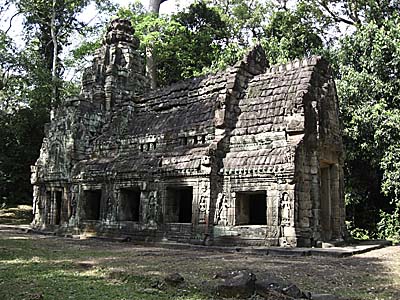
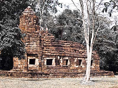
A Hospital Chapel
This pretty, smaller building, one of the outer monuments in the Preah Khan site, which looks like a chapel, might have been one of the 102 hospitals built in the reign of Jayavarman VII. It looks pretty similar to the most remarkable remaining building at Prasat Ta Muen at the Thai/Cambodian border in the Dangrek Mountains. Image by Asienreisender, 2006
Generally they lived in simple, wooden huts, often on stilts to be protected from rising water levels in the rainy season. The interiour was simple, there was practically no furniture, a few things like stone jars for water, hollow coconuts as cups, some more simple kitchen tools and a simple straw mat on the floor where the people sat on.
The richer people lived in better houses, built of more sustainable tropical wood, sometimes hard wood of which some rare, decorated pieces survived until today.
The diet based, as today, on fish and rice. The fish came and comes mostly out of the Mekong River system, including the Tonle Sap and the great lake. This thousands of years old source is now under threat by the erection of the monuments of our times: the Damming of the Mekong is undergone in Laos and Stung Treng. The construction of many dams is predicted by scientists to have a devastating impact on fisheries and rice production and vegetable agriculture along the lower Mekong River.
The old Khmer's food was spiced with cardamom, tumeric and black pepper, which came maybe from Kampot. The salt used in Angkor came for sure from Kampot's salt salines.
The people of Angkor knew a variety of music instruments. There probably were many festivals when musicians played, singers sang and dancers danced. Nowadays, the old traditions are declined by the use of mp3-players and enormous loudspeakers, befouling the wide surroundings with a dull 'bam-bam-bum'. There were also a number of games and other public attractions going on as cock fighting, snake charming, team games and much more. We see some depictions of that at the Terrace of the Elephants in Angkor Thom.
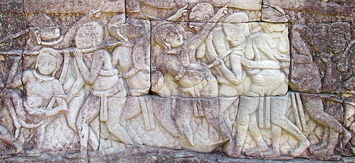
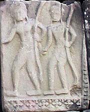
Common People
Commoners with ox carts. Bayon, bas relief. Image by Asienreisender, 10/2015
Religion
Religion played a central role in the ancient Khmer society. The higher priests were the key group of the upper class. Religious buildings and foundations, apart from the grand monuments, were abundand in Angkor. Priests had a great influence on the mindset of the people and society of Angkor.
Angkorean Library
One of the two 'outer' libraries at Angkor Wat. The knowledge of the priests was collected in these buildings. But not only that - the libraries were also a place for bookkeeping of the imperial resources. Unfortunately not a single piece is left. Image by Asienreisender, 2006
The dominating religion for a long time was Hinduism. Unlike in India, where Brahma was (or is) the central god, in Angkor the central role was shared between Shiva and Vishnu. In the late 12th century king Jayavarman VII changed the state religion to Mahayana Buddhism. That was a revolutionary, severe break in Angkor's history, and particularly of significance for the cast of the high priests, who were, in their view, bereaved of much of their power and privileges. Jayavarman VIIth succeeder changed the state religion back to Hinduism, and angry Hindu priests destroyed Buddha statues and replaced them, as for example the Buddha statue which was situated in the central shrine of the Bayon.
Decades later there was another change in the state religion to Theravada Buddhism. Theravada was introduced by a Burmese monk with the name Shin Tamalinda, who came to Angkor claiming he were a descendent of a former Khmer king. Theravada Buddhism set an end to the hereditary of priestdom and marked a sharp change in the former status of the clergymen. From now on everybody could become a monk and live from alms, begging in the mornings in the neighbourhoods. This religion overcame the time until today, with the remarkable interruption of the time of Democratic Kampuchea.
Funerals were carried out in different ways. Dead corpses were brought outside the city to be eaten up by wild animals or there was a cremation with a religious ceremony.
Terrace of the Leper King
The godking was the highest religious authority. He was a devine being, and incapable of doing wrong or bad. The king's life was pompous, and he was in total power.
The high priests were the ruling cast, closest to the king. There was no separation between religion and state. The whole legitimation pattern of the king and the ruling class was based on religion.
On this background it was a weak point, that the king, as a supernatural being, was mortal. A compensation for that was the construction of bombastic graves. Angkor Wat had the main purpose to serve as a burial site exclusively for the godking Suryavarman II. Unlike the Christian cathedrals in Europe, Angkor Wat was not open for the common people. After the completition of the egomaniacal monument, they were excluded from visiting it.
After the establishment of Angkor Thom as a new capital, north of the royal palace was a large, representative cremation site constructed - the 'Terrace of the Leper King' (image).
Image by Asienreisender, 9/2015
6.
The Human Costs for the Monuments
The pompous architecture, although impressing by it's artful perfection, is also a witness for the overweening egotism of the ancient Khmer kings. No sacrifice was too big not to be done for the demonstration of their superiority and priggish wish of surviving eternity.
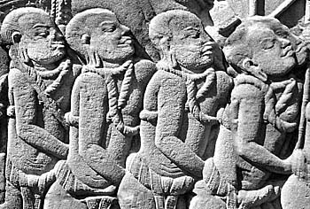
The Slaves of Angkor
A relief with the slaves of Angkor. It seems very much that the Khmer of the time enslaved hundreds of thousands of their Southeast Asian neighbours, who were defeated in the many wars the empire fought to conquer great parts of Indochina. It can also be supposed that there was a steady flow of 'new', incoming slaves to Angkor. That provided the empire with an abundance of working power. Only a smaller fraction of the slaves were Khmer, particularly those who couldn't pay their depts to superiors.
There were different kinds of building material used. Bricks and laterite stone was available locally, but the three kinds of sandstone used for the monuments had to be carried from the Kulen Mountains, some 40km away. It was a heavy work already to break out big blocks. But to carry them over such a long distance was a major challenge.
A number of the blocks weight around five tons. One block used in Angkor Wat weights eight tons, and the biggest of all is built in Praeh Vihar, with a weight of ten tons.
The transport of the stone blocks from the Kulen quarries was managed at least partially on rafts, towed by elephants and water buffalos. The animals who fell victim to the huge building efforts over centuries have never been counted.
But to transport the really huge, several tons weighting blocks even the elephants lacked the stamina. They were carried by hundreds of slaves each block, using a great number of wooden or bamboo sticks as handles. It must have been an incredible fag.
Most difficult it must have been to put the very heavy blocks finally into their destination.
The death toll for the construction was probably enormous. Certainly many bloody accidents happened. Above all the building programs required the muscle power of ten thousands of human workers. The heaviest work was certainly done by slaves, people, who were often born into slavery and couldn't imagine anything else than their role as slaves. Others were captives of the many wars the empire led, and forced from their former lifes into slavery.
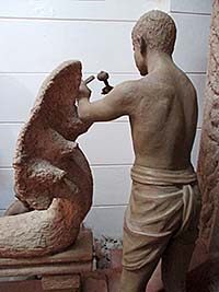
Depiction of a medieval Khmer craftsman in the visitor center (museum) of Phanom Rung. Image by Asienreisender, 11/2015
Even under a given moderate building schedule the losses would have been large. But one has to consider the extreme speed under which the grand monuments were finished. Angkor Wat alone is an extraordinary example for it. Angkor Wat is much bigger in size than any other religious monument on earth. Compared to the European builders, who ned 200 to 300 years to build the big cathedrals, gigantic Angkor Wat was completed within about 35 years. The king of the time, Suryavarman II, was probably extremely eager to get the monument finished within his lifetime, because it's purpose was nothing more than to serve as his exclusive graveyard. It seems, all the suffering and losses of lifes, what was the price for the egomaniacal construction, didn't bother him at all.
No doubt, Angkor had a huge reserve of slaves. That's, where empires are built on - the exploitation of labour. And a slave's purpose is to work. If they get old and can not work anymore, they are not only worthless, but it costs resources to feed them. The brutal slaveholder regime therefore probably killed anyway those slaves who could't make themselves useful anymore. Some might have been sacrified in a religious ceremony, others just butchered at the roadside.
For the craftsmen, particularly those wo did the fine arts, it was probably a very honour to serve their godking. And a cast of priests gained a central status, leading the sacred ceremonies in the grand monuments.
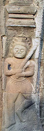
A Slave Caravan
All hitherto human civilizations are based on the exploitation of labour. The most brutal form of that is total slavery. Unlike the modern form of slavery on 'free' labour markets, in traditional slave societies the slaves were the physical property of their owners. A division was made between private slaves and state slaves. Image by Asienreisender, Bayon, 9/2015
7.
Angkor's Zenith
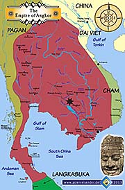
Map of the Empire of Angkor
A map of the empire of Angkor at about it's greatest geographical extesion around 1200 CE. Though, borders were seldom clear and permanently moving. I personally have never seen an Angkorean monument south of Phetchaburi (the southernmost is Wat Khamphaeng Laeng) on the Malay Peninsula.
Yet there was no competitor who could cope to challenge Angkor. But after the independence of Sukhothai in 1238 CE the Siamese emerged as an ever stronger growing threat. There were centuries of war between the Siamese and the Khmer.
Later a second archrival for the Khmer empire approached from Tonking, making his way step by step southwards: the Annamese, later known as the Vietnamese.
The climax of the Angkorean empire was reached in the time of Jayavarman VII (1181 - 1206/1220). The empire streched from the South China Sea in the east to the Andaman Sea in the west, in the north and the east it was only limited by natural borders as oceans, mountains and huge, impassable tropical rainforests.
In the heyday of the early 13th century, Angkor Thom was built. Angkor Thom became the new capital of the empire. It's centerpiece is the famous Bayon temple. The Bayon is world-known for the 'Smile of Angkor', displayed in dozens of Boddhisatva heads who show actually king Jayavarman VII himself.
Though, the beginning decline of the great empire dates also back to it's heyday. The reason for the decline wasn't that much an 'imperial overstrech', for Angkor didn't have powerful enemies at that time anymore. After Jayavarman VII defeated the Champas in the east, there was no other power in the world region which could cope with the empire. The Tai tribes, who later formed themselves empires and challenged and eventually defeated Angkor, were yet in an early stage of development and still vassals of the Khmer empire (like early Sukhothai).
The decline rather begun inside the empire. The ambitious, vast building efforts in Jayavarman VIIth reign overstreched the resources of the empire. The tuning of the Angkorean society came out of balance. Too many unproductive people were sustained as all the many priests, the aristocratic class, the big royal family itself. The wasteful godking cult alone employed more than 300,000 people. All the craftsmen who worked in the many and huge building sites and a huge army had to be fed and organized.
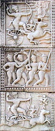
The Champa Wars
The Angkorean army went out into all directions to conquer and enslave the neighbouring nations and to expand the territory controlled by the empire. Here a battle scene, shown in the bas reliefs of Bayon. It's probably glorifying the wars against the Cham, led by Jayavarman VII. Image by Asienreisender, 9/2015
The Transport System - Royal Highways and Canals
Angkor capital marked indeed the center of the empire. It was therefore also the center of the transport system. That consisted of a huge and dense net of canals who where built through the alluvial plains of Cambodia; particularly the Mekong Delta had a canal net which dated back to the pre-Angkorean time; it was dug in great parts already by the earlier hydraulic masters of Funan.
See also: The LIDAR (laser) revelations at Angkor.
A Hospital Chapel
Following an inscription in Ta Prohm, Jayavarman VII ordered the construction of 102 hospitals along the royal highways. They are often referred as 'hospital chapels' (see the image above which was made in Preah Khan). This one is placed along the royal highway from Preah Khan to Phimai at Prasat Ta Muen in the Dangrek Mountains. Image by Asienreisender, 1/2010
Additionally to the canal network, the medieval Khmer built a large highway system to connect all their places, including those they conquered in neighbouring countries. The most famous royal highway of this kind is certainly the one which leads from Preah Khan northwards, crossing the Dangrek Mountains at Prasat Ta Muen and leads further onto the Khorat Plateau, via Phanom Rung and Muang Tam to Phimai. It's an old road which has been massively improved in the reign of Jayavarman VII (1187 - 1226(?)). Along the road were resthouses, small temples and some of the famous hospitals placed. Rivers, canyons and streams were bridged. Alltogether this road spanned over 225km. Nowadays it's almost completely gone, but over parts are traces visible by aerial photographs. The northernmost imperial outpost on the Khorat Plateau (nowadays Isan, Thailand's northeast) which I personally saw is Phra That Narai Yeng Weng in Sakhon Nakhon. However, there are hints of a road connection between Phimai and Vientiane/Vieng Chan, and it seems to have been (widely) congruent with what is nowadays bombasic highway no. 2.
Another major road connected Angkor capital with Lava/Lopburi in nowadays central Thailand, which was for a time a second capital of the Angkorean empire. There was certainly an older roadnet in existence already in those parts of Thailand where the Dvaravati Culture already existed. Nakhon Pathom and Ratchaburi are only two of more places who where conquered in the early 12th century by Angkor and incorporated into the empire. There is no hint that the old trade route towards the Three Pagoda Pass was upgraded to a Khmer highway, but the existing road was certainly used over the time when Angkor ruled over central Thailand.
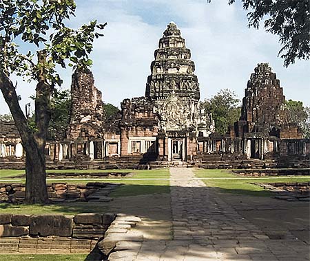
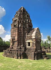
Phimai
The Angkorean sanctuary Phimai on the Khorat Plateau. Image by Asienreisender, 1/2010
The southernmost Khmer outpost on the Malay Peninsula I personally witnessed is Khamphaeng Laeng, a minor temple site in Phetchaburi on the northern part of the Malay Peninsula.
There was also a major road between Angkor's capital and the grand site of Champasak in south Laos. No doubt, connected roads led furtherly northward. Also, large parts of the middle section of the Mekong River were under control of the imperial fleet.
However, there were more major highways and a supplementing network of smaller roads, alltogether an extensive roadnet which maintained the communication of the imperial center with it's periphery. One can assume that the ruling cast of Angkor was very well informed of all what was going on in the empire, including the most remote outposts.
The transport net was meant to travel all kinds of people and goods, including the imperial army.
Many of the highways of our times in Cambodia, Laos, south Vietnam and Thailand are built on top of the ancient Khmer highways. Most witnesses of the old times have disappeared without leaving a trace.
Being able to establish it's authority not only over a limited 'royal domain' and a number of royal towns - as does the typical feudal state - the hydraulic regime places it's administrators and officers in all major settlements, which virtually everywhere assume the character of government-controlled administrative and garrison towns.
Effective governmental control involves first the political and fiscal superiority of the directing agency and second the means for conveying commands and commanders to the subcenters of control. The desire to exert power through the control of communications characterizes all political hierarchies; but circumstances determine the extent to which this desire will be satisfied. The overlord of a feudal society valued fast communications as much as any Oriental despot; but the spotty distribution of his administrative centers and the politically conditioned lack of good roads prevented his messages from traveling as quickly or as safely as did the messages of the hydraulic sovereign.
The development of long highways and navigational canals is only another manifestation of the extraordinary construction potential of hydraulic society. Similarly the development of effective systems of communication is only another manifestation of it's extraordinary organizational potential. Almost all the hydraulic states bulwarked their power by elaborate systems of 'postal' communication and intelligence.
The term 'post' or 'postal service' express the fact that persons are 'posted' at intervals along the road; the formula 'relay system' points to the regulated interaction between the persons so posted. (...) On occasion the post handled rare and perishable goods (fruit and fish for the court, etc). But it's primary aim was the movement of persons of privilege (envoys, officials, foreign diplomats), messengers, and messages - these latter including intelligence of the most confidental, important, and delicate nature.
(...) In the hydraulic world, private communications were not lacking, but they never competed with the far-flung and effective relay system of the state. By running the post as a political institution, the representatives of Oriental government maintained a monopoly over fast locomotion, which - interlocked with an elaborate system of intelligence - became a formidable weapon of social control.
Karl A. Wittfogel: "Oriental Despotism - A Comparative Study of Total Power"
8.
The Decline of the Empire
Experts are discussing since long the reasons for Angkor's decline. The first-glance, conventional explanation is the Siamese conquest of 1431 CE, when troops from Ayutthaya under king Paramaraja II besieged the great city for several months and finally captured an pillaged it. But that's not all. The decline had already begun long before that key event. After the climax of the empire in the early 13th century, from around 1400 CE on the construction activities were much reduced. It's supposed, as mentioned above, that Jayavarman VII already overstreched the empires sources for his extremely ambitious building activities. In the 200 years after his reign a slow, supposedly accelerating decline happened.
Ta Prohm
After Angkor was sacked in 1431 CE, it became a more and more abandoned place. Angkor Wat was never completely abandoned, Angkor Thom probably since 1629 CE, the fate of the other sites is not known in detail. But the tropical forest grew step by step back, after the Khmer capital was moved to the lower Mekong River.
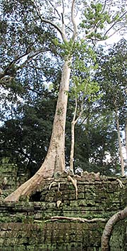
Here you see Ta Phrom, overgrown by a large figtree. Many of the Angkorean buildings shared this fate, and some have been left in this state to illustrate how Angkor looked before the restoration started. In fact the buildings were much more overgrown by a great number of different plants. Image by Asienreisender, 2006
By the way, the conquest of 1431 possibly wasn't the first in which the Siamese succeded. After Jayavarman VIIth reign the first Siamese kingdoms as Sukhothai and Si Satchanalai emancipated from Khmer suzerainty. First they were only concerned to keep Khmer troops away from their own new and small kingdoms. There must have been bloody, cruel, devastating wars between the Siamese and the Khmer at the time. In the 14th century, with the emerge of Ayutthaya, what was never a Khmer vasall state, a really threatening competitor rose up at the western borders of the Angkorean empire. There was (maybe, but not for sure) a first, succesfull Ayutthayan attack on Angkor in an unknown year between 1372 CE and 1421 CE, but the empire could yet half-way come over it. Angkor Thom is supposed to have been conquered then already for a first time.
The real reasons of the decline is probably due to a combination of several causes. The long-lasting wars between Siamese and Khmer, and the (double?) fall of Angkor Thom clearly weakened the empire. The Siamese also sabotaged the irrigation system, on which the provisioning of Angkor depended so much.
It is also possible that the excessive building activities drained so much wealth and power out of the society, that it led to long-term unrests and weakened the state.
The change to Theravada Buddhism had also a great influence on the Angkorean society. From the mid 14th century on Theravada was the dominating religion in Angkor. Since the hereditary monopoly of the priest cast was broken now and everybody could become a monk, the view on life and afterlife changed considerably. It seemed now much more pious to concentrate on nirvana by leading a more modest life, not accumulating power and status symbols anymore but meditation and dedicating oneself to immaterial, spiritual purposes. Mere contentment was now also seen as a value. All the Khmer kings who claimed to be a god were seen in another light, for not even Buddha had claimed to be a god.
The Substance of Empires
Empires come and go, they rise and fall. They are always built on a highly stratified class society, violence, exploitation, injustice and are not sustainable. They are a vehicle for class struggle, for the sake of a very small part of the population on top of the social pyramid. The weening egotism of the ruling class of Angkor is perfectly expressed in monumental Angkor Wat, which was built on the blood, the skulls and bones of at least ten thousands of slaves and workers, primarily to serve as a graveyard for one person only - godking Suryavarman II. Angkor Wat is a monument of insanity, and makes a great symbol for imperialism. Images and photocomposition by Asienreisender, Kampot and Battambang, 5/2015, 9/2015, 2016
It can be that the mental change and consequently the alteration in lifestyle led to a lack of workers to maintain the great irrigation system. With the decline of the irrigation system, the whole society came in trouble. The organization of Angkor was focused over all it's history on a strong centralized power. The new religion of Theravada Buddhism has been somewhat counterproductive to the idea of governmentally organized great state projects and workforces.
Theravada also sets the barriers of taking lives higher. It's a very bad thing to kill for one's kharma and next reincarnation. That didn't stop Khmers from killing, of course, but it's at least hampering aggressive, warlike ambitions.
Another often claimed possible reason of Angkors decline lies in ecological degradation. Particularly the deforestation in the greater Angkor region until up to the Mount Kulen slopes had a great impact on the water system. Fertile soil might have been washed out after heavy rainfalls, floods might have appeared, draughts therefore in the dry season and silt blocked the canals. Maybe even the amount of rain was reduced due to the disappearance of the forests.
There must have been a great demand for timber to build houses and as an energy resource for a growing population, as well as the extension of farmlands was directed into the surrounding forests. One has to keep in mind that the population in the area what is now roughly Angkor Archaeological Park reached a million inhabitants.
Blocked canals containing mostly standing water are a great habitat for mosquitoes. The outspread of malaria and dengue might have been an issue as well.
Well, if the environmental degradation theory is correct, it would be a warning also for contemporary Cambodia. The environmental crisis in Cambodia with the desastrous deforestation rate is much larger in scale than it had ever could been in ancient Angkor, which could trigger only a local desaster. Though, it was bad enough, anyway.
9.
Aftermath and Heritage
Ironically the longest lasting influence of Angkor is living on in Thailand. The Siamese conquered Angkor in 1431 CE and set an end to the empire, but they overtook many customs, particularly at the royal court, who are still in practice. The concept of a 'devaraja', a godking, is just one of many adaptations the Siamese high nobility took over from the ancient Khmer. The Tai tribes, who began their history in Southeast Asia after their tribal times and early phase as Khmer vassal states, as in Sukhothai and Lopburi, advanced later to the heirs of Angkorean culture.
Preah Khan
It's curious to see that almost all the pillars of Angkor's temples are square-shaped. That has probably to do with the Khmers believe that in round-shaped pillars (as in trees) ghosts and spirits live. For the very few exceptions of buildings with round-shaped pillars it's supposed that the builders intention was to attract spirits to move in.
The only building with round-shaped pillars I personally saw is this one at Preah Khan. It's supposed to have been a rice granary. Image by Asienreisender, 2006
No Westerner has ever been in Angkor when it was still a vivid society. In it's heyday Angkor was completely unknown for the western world. Although Marco Polo visited Angkor's neighbours, the Cham, in 1288 CE, he didn't mention Angkor in his travel narrative. Neither did the Italian friar Odoric of Pordenone, who travelled in Indochina in the 14th century. Angkor does not appear in a single western record. The first Westerners who arrived at Angkor were Portuguese in the mid 16th century. At that time the empires 'glory' was already history. Later, when explorers like Henri Mouhot arrived in the mid 19th century, they couldn't believe that the barbarous Khmer People once built such a site as Angkor Wat. Mouhot believed falsely the ruins were much, much older than they are and belonged to another people. Even the savage Khmer of the time themselves didn't believe that the monuments were the work of their ancestors; they thought they were built by giants a long time ago, as Adolf Bastian was told when he came here short after Mouhot.
Even the revealing of ancient Angkorean history is a western work. After Mouhot published his discoveries in Indochina, the western world became interested in the ancient ruins and culture. It was the French École d’Extrême-Orient who first excavated the ruins of Angkor Wat and Angkor Thom from the jungle and started the scientific research of it's past.
Historical research is mostly based on the excarvation of the ancient ruins and the carvings in their walls who tell us many stories about the past. The Angkorean libraries therefore are all empty, the old Khmer writings, written on palm leaves, are gone. They couldn't stand the tropical climate. The only existing handed down written source on Angkor is the one of the Chinese envoy Zhou Daguan (also: Chou Ta-Kwan), who spent about a year in Angkor. That was in 1296/97 CE. Zhou Daguan wrote a report titled 'The Customs of Cambodia' for the Chinese emperor.
So, what we know nowadays about Angkor is a considerable amount of information, but it's still a fraction only what Angkor really was and what was going on there. The 'whole picture' we will never reconstruct, but there will be more found out by new technological methods. Aerial and satellite photography as LIDAR now can reveal much more in addition to what traditional methods did already.
10.
Sources
This article is based on many visits to Cambodia's ancient sites. Moreover it's based on a number of publications. You find a list of them on the Literature page. Particularly Zhou Daguan's 'The Customs of Cambodia' and John Tully's 'A Short History of Cambodia' give a good and quick overview on medieval Angkor. Karl A. Wittfogel, 'Oriental Despotism - A Comparative Study of Total Power' is a grand basic work on the evolvement of the first civilizations and the comparison of Oriental hydraulic civilizations with their western contemporaries, the classic Greece and feudal Europe. However, it's not at all exhausting; it comes together with more books, uncounted articles from newspapers, magazines, (qualified) websites and movies, both fiction and documentary. Sometimes, a good talk with a connoisseur of a certain topic provides me with facts, ideas, inspirations and innovations and/or reveals a mistake.
 The hydraulic civilizations that maintained large armies generally also had large populations. (...) The masters of the hydraulic state, who monopolized coordinated military action, could - if they so wished - raise large armies. Their mobilization potential was entirely different from, and greatly superior to, that of feudal Europe.