Nan
Nan is a geographically isolated town in the north of Thailand. Situated at the banks of Nan River in a wide plain, two mountain chains separate it from western and eastern neighbours. The province of Nan is bordering Laos in the east with Sanyaburi as a next town east of it.
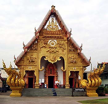
One of the medieval temples in Nan town. Image by Asienreisender, 11/2010
Nan and Sanyaburi are separated by the Luang Prabang Mountain Chain. The highest mountain here is Doi Phu Kha (2,079m), close to the Laotian border. At the western horizon of the town stretches the Phi Pan Nam Mountain Chain, cutting it off the next western province Phayao.
In the years until 2011 the main road from Uttaradit via Phrae has been improved, and Nan became one of the notorious highway circles, leading around the town and being the backbone for a continuing, grand-style urbanization. The other direction to enter or to leave Nan is the northern route via Chiang Kham or border crossing Laos. The improvement of the road connection via Laos to China will trigger more traffic, trade and pollution here. It comes with a new bridge over the Mekong River at Ban Pak Beng.
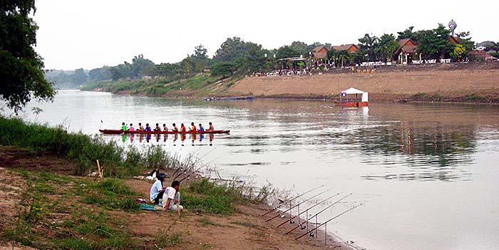
Very popular are the annual boat races on Nan River. This custom is centuries old and held in many Thai places with larger waterways (see also the 'Royal Barge Procession in Lang Suan') at the end of the raiy season, when the water level is highest. In the Ayutthaya era the regattas were meant to keep young men fit for military purposes.
Nan River, who joines Ping River at Nakhon Sawan, is one of the largest tributaries of the Chao Phraya River, who is the biggest river within Thailand. Image by Asienreisender, 11/2010
A Short History of Nan
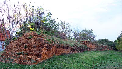
Remains of Nan's old city wall. What's left is only 400m of the original, and it's actually not very old - it was built in 1885, replacing an older palisade wall, Image by Asienreisender, 4/2011
Although there are a few traces of stone-age people, settlements here dont' date back further than to around 1280 CE. As a small, geographically isolated principality, Nan was over longer times independent. However, all the neighbouring states were larger and more powerful and annexed the principality over times. So it came first for a short time under the control of the kingdom of Sukhothai, soon later under the rule of the kings of Lanna and, from 1558 and again from 1714 on, under that of Burma. After the final Burmese retreat in 1788, Nan gained again a kind of independence. In the French-Siamese treaty of 1893, Nan lost part of it's easter territories to then French Indochina; these land is now part of neighbouring Laos. Remarkably, it became incorporated into the Siamese state as late as 1931. Nan's remotness and the large, dense forests made it a good terrain for guerilla warfare, what was a reason for a part of the Semi Thai resistance to operate here in the region in the Second World War. In the 1960s and 1970s, the communist insurgents of the People's Liberation Army of Thailand (PLAT) fought here against the Thai army.
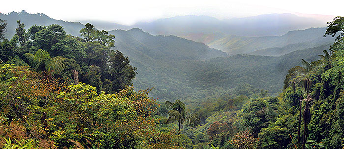
Doi Phu Kha National Park is Thailand's largest national park in the whole north of the country. It has plenty of natural riches and the mountainous surroundings are the source of many streams and some rivers, as the Nan River. The highest mountain, Doi Phu Kha, is 2,079m high. Particularly teak is growing here, as it did in the past in the whole large region of the Greater Golden Triangle. The whole park is part of the Luang Prabang Mountain Range. However, all the park status does not safe the nature from destruction. Deforestation is going on, and as always there are high officials and the military involved in the predatory exploitation. Image by Asienreisender, 4/2011
People and Economy
The mountainous parts of the province are mainly populated by Tai Yuan, Tai Lue and other tribal people like Shan, Hmong, Phuanand Tai Khuen. Nan town has a population around 22,000 people.
The economy is based mostly on agriculture. The massive logging of the last remaining forests is part of it, together with fishing, rice production and vegetables and fruits. Tourism is massively on the rise and makes now also a considerable part of the economy.
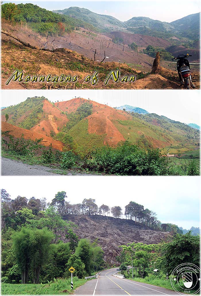
As everywhere in Southeast Asia, deforestation is going on in a rapid speed. Here, the formerly vast mountainous forests in Nan Province are getting logged and burned to give space for agriculture, preferably cash crops. Images and photocomposition by Asienreisender, 4/2011, 2016