The Landscapes of Krabi
Krabi is a small province capital of the province of the same name at the shores of the the Andaman Sea. It's embedded into a phantastic nature with a great variety of habitats as tropical rainforests, limestone mountains, mangrove forests, rivers, streams and lakes and hundreds of islands in the sea. Part of these islands and some sand beaches around Krabi town make the region a well-visited touristic region. The expansion of the touristic infrastructure together with the general urbanization means a heavy impact for the nature.
Krabi River
The eastern and northern banks of Krabi River are coined by dense mangrove forests. Image by Asienreisender, 2005
Krabi town is factually a small place situated at the banks of the Krabi River (Thai: Maenam Krabi). Krabi River itself is merely 5km long, but it is only the lower part of a longer channel who stretches 31 more kilometers into the surrounding, sourcing from Phanom Mountain. The upper part of the river is named Khlong Krabi Yai. Around the river and it's tributaries are about 100km2 of mangrove forest. At the coastal part there are 12km2 of tidal mudflats, exposed to the eye at low tide. A number of partially very rare or unique birds are living in this habitate.
Nowadays Krabi town, despite of it's old history, is factually a new place at the spot where it lies now, that is the northern bank of Krabi River's mouth. It looks pretty tidy and it's roads are aligned in a modern chessboard pattern. The opposite, southern banks of Krabi River are overgrown by wide mangrove forests. Meanwhile, heavy urbanization spreads out along the big roads who lead outside of town.
Krabi City
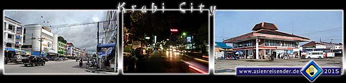
Krabi city respectively town is a small, new place which is not anyhow distinctive. It's remarkable tidy and pretty clean. The photo right shows the bus station, some kilometers outside the center. Images and photocomposition by Asienreisender, 2009, 2005, 2010, 2015
Krabi's population is quite heterogene - the majority of the province's people are certainly Thai buddhists, together with Thai-Chinese. More than 40% of the inhabitants are muslims and a certain part of the population are Moken, the so called sea-gypsies. As it happens in touristic areas there are sometimes tensions and aggressions, particularly aggressive business behaviour. Many boatsmen at the river banks are pretty obtrusive. Overprizing in the tourist places happens occacionally.
Krabi's Night Market
At early evening the stalls of the night market are getting built up near the river banks. A great variety of good and cheap food is offered here. There is another, bigger food market in the city center (see below). Image by Asienreisender, 2010
The climate is coined by the tropical southwest monsoon, who brings annual heavy rains in the six month from May to November.
The economy of Krabi is coined by tourism, agriculture and fishing. Among the agroindustries are the notorious rubber and palm oil plantation economies, together with orange plantations. The statements for the population vary heavily between 30,000 to over 50,000 inhabitants in Krabi town and 500,000 to 1,500,000 people living in the whole province.
Circa 10km outside of town lies Krabi International Airport, where flights to and fro Bangkok, Kuala Lumpur, Singapore and Ko Samui are available. While in the 1990s the buses still drove their passengers into the city center at the river banks, the new bus station is nowadays seven or eight kilometers outside of the town's center.
Beside the city of Krabi there are nine more towns in Krabi Province. The neighbouring provinces of Krabi are Phang Nga, Suratthani, Nakhon Si Thammarat, Trang and, west of it behind the bay of Phang Nga, the touristic center Phuket.
Krabi's Markets & the Restaurant Boat
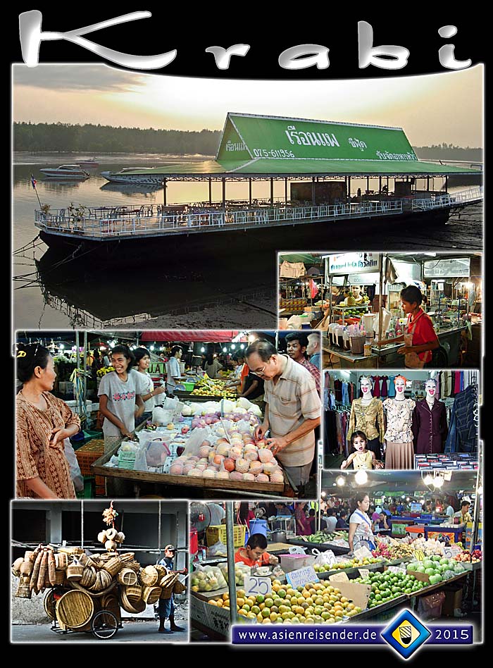
Krabi's famous restaurant boat at the pier, here at low tide in the evening. Known since many years, in the last years it seemed to run out of guests. The fresh market therefore is always crowded. Images and photocomposition by Asienreisender, 2005, 2015
The History of Krabi
Krabi is a place which is inhabited by humans since an incredible long time. Estimations vary between 25,000 to 40,000 years back that humans lived here already. The cave of Lang Rongrien, some 15km outside of town, could be one of the oldest settlements of homo sapiens in Southeast Asia. But also in many other caves and places have been prehistoric stone tools, beads, pottery, coloured cave paintings and remains of human skelettons found. At the end of the last ice age about 10,000 to 12,000 years ago the scenery changed drastically; particularly the sea level rose considerably. Some caves in Krabi province show prehistoric wall paintings who date back 2,000 to 3,000 years.
The Cave of Lang Rongrien
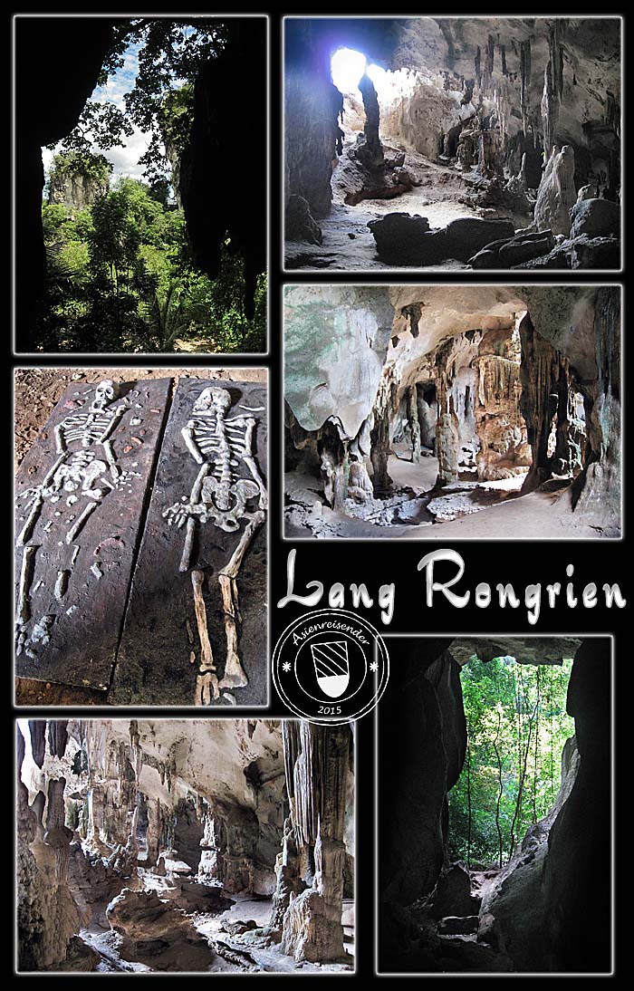
The stalactite cave of Lang Rongrien is seen as one of the earliest places where homo sapiens settled in Southeast Asia. The oldest estimation for the camp is counted 45,000 years back. Lang Rongrien is about 15km from Krabi town on an island in the Krabi River system, surrounded by jungle and mangrove forest.
The two skelettons are a reconstruction of human remains how they looked when discovered and exhumated. There are some more of the kind in the cave.
Images and photocomposition by Asienreisender, 2009, 2015
In what was the middle-ages in Europe, Krabi was a tributary vassal of the kingdom of Ligor (see: Nakhon Si Thammarat). In later centuries Krabi was still administrated by Nakhon Si Thammarat. It got city status in 1872 and an own province capital in 1875. Since then it's directly subordinated under the central government in Bangkok. However, the capital was moved in the year 1900 to the place where it is situated now, what makes Krabi actually a new place.
The coat of arms of Krabi shows two crossed swords ('krabi' is Thai for a certain kind of ancient sword) and the mountain Phanom Bencha, the highest of the province (1397m). In the background is the Andaman Sea (part of the Indian Ocean) is to see.
Tourism and Natural Sights
Krabi is a destination of mass-tourism, although it's not that crowded and spoiled as Phuket, Ko Samui or Pattaya. In the December 2004 tsunami Krabi's coasts were heavily damaged and many people died here.
A couple of beaches are dotted around Krabi town. The most touristic one is certainly Ao Nang, just a couple of kilometers from town. Seamed by palm trees there is a long line of guesthouses, restaurants, bars, resorts, small supermarkets etc. for the mass taste.
The double beach of Railay is on a peninsula, isolated from the mainland by a bigger, pillar-shaped mountain. The seaside end of the peninsula is also mountainous. Railay is therefore only accessable by boat. The west beach of Railay is sandy and merely 5km away from Ao Nang. The east beach is muddy and more or less a mangrove swamp, not good for the common beach activities. Therefore the cheaper accomodation is to find here. Railay has been completely washed out by the 2004 tsunami, most of the people who were here at the time died.
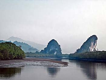
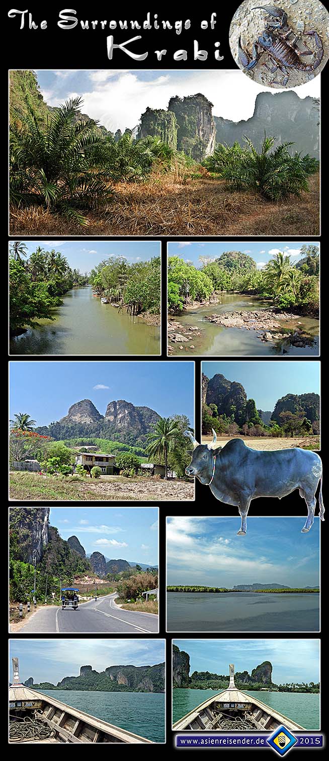
Landscapes of Krabi
Landscapes of Krabi
The landscapes of Krabi are among the most impressing of Southeast Asia and kind of legendary. The first three images show the scenery of the peninsula of Railay Beach.
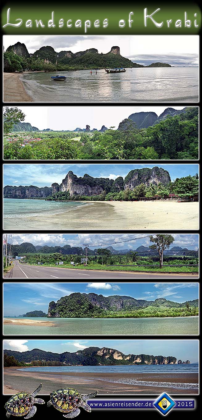
Images and photocomposition by Asienreisender, 2009, 2010, 2015
Krabi Marine Life
The floating restaurant in the river was once an attractive place to eat. Due to bad management it lost it's customers.
The Thai fishing boats at the very end of Ao Nang Beach are as picturesque as the whole scenery.
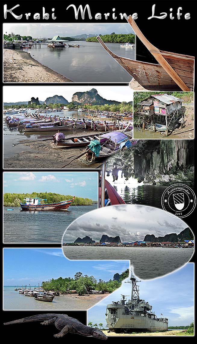
Everywhere are touristic boat tours offered. The trips lead along mangrove shores, through a pretty big stalactite cave and many islands. One of the tourist attractions is the so called 'James Bond Island', an isolated, large rock in the sea (see the top image in the left column). Another tourist trap is the floating village, where Moken People sell tourist souvenirs and food. There is also a discarded Thai battle ship to visit at one of the beaches.
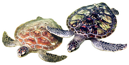
Among the inhabitants of the mangrove shores are large varans, the monitor lizards.
All images and photocomposition by Asienreisender, 2005, 2009, 2010, 2015
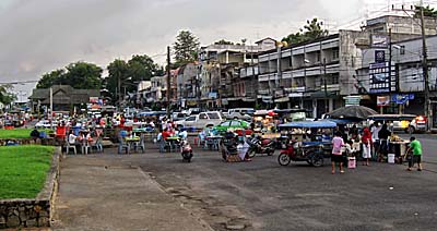
The Surroundings of Krabi
All images and photocomposition by Asienreisender, 2005, 2010, 2015
To enter the accordion with the collages, click on the chapters.
All images and photocompositions by Asienreisender, 2005, 2009, 2010, 2015
The island group of Ko Phi Phi is one of the most touristic in whole Thailand. It's pretty pricy and crammed by mass-tourism. On Ko Phi Phi was the famous movie 'The Beach' produced in the late 1990s.
Altogether are 130 islands stretched over 120km along Krabi's coastline. Also Ko Lanta is an island in Krabi Province, with an emerging touristic infrastructure.
The increasing number of touristic boats, particularly longtail-boats, contribute to the pollution of the area. Besides oil and petrol and other chemicals who drain into the waters, the noise pollution is regularly heavy.
Susan Hoi
The fossil graveyard of Susan Hoi. Image by Asienreisender, 2005
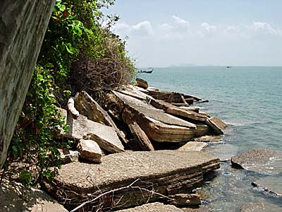
Some 20km north of Krabi town lies the short coastal stretch of Susan Hoi, also called the shell graveyard. It's a place with great clusters of fossil shells. In earth-historical times the spot was a big freshwater swamp, inhabited by molluscs of the size around 2cm. At a later time seawater intruded the area and the molluscs became pressed, forming plates of fossiled shells, some 40cm thick. Their age is estimated of around 40 million years. At high tide the place is mostly flooded.
Abouth 5km north of Krabi lies the Tiger Cave Temple (Wat Tham Suea). Short behind the temple one can climb up over 1,200 steps passing into a mountain valley with some more interesting caves.
The bizarre-shaped limestone mountains, part of the Tenasserim Mountain Chain, are perforated by uncounted caves like a Swiss cheese. Some of them form very large labyrinths. Most of them are stalactite caves. Also many of the islands continue the shapes of the mountains. Mountain climbing is a popular sport here since decades already.
Some national parks and nature reserves are declared in Krabi Province. Hat Noppharat Thara / Mu Ko Phi Phi National Park is one of them, stretching along the coastline and covering Ao Nang, Railay, the Ko Phi Phi Islands and more. That mass tourism happens inside the parks does the nature of course no good... profit over people, profit over nature.